


Fuerteventura is about 20 million years old and is the oldest formation of all Canary Islands. It is geographically twinned with Lanzarote as both are on the same plateau with only 40-50 metres of sea depth between them.
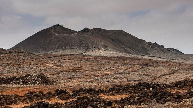
Fuerteventura, like all other Canary Islands, is of volcanic origin. The first eruptions were well below sea level and the formations were subsequently pushed up. These early eruptions show the typical gentle slopes of the Betancuria Massif. Later eruptions – above sea level – have the traditional “volcano-like” shapes. The latest eruption on Fuerteventura was in what is now La Oliva, about 5.000 years ago.
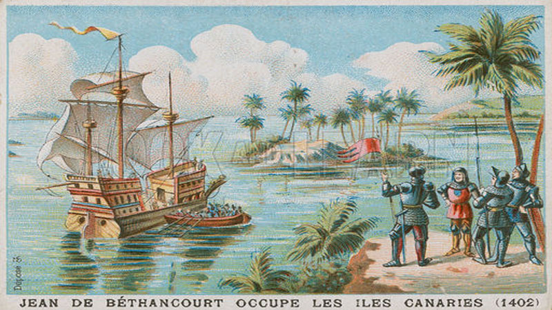
The first inhabitants of Fuerteventura are believed to be of North African origin but, according to recent genetic research, there were several immigrations of at least three types of human races. Significant exploration of the island began in the 15th century with Jean de Bethancourt and Gadifer de la Salle.
Fuerteventura – at that time only the North – was developed for tourism as from the early 1970´s. The South followed about 10 years later.
Geographical History.
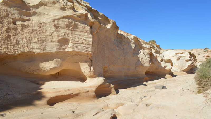
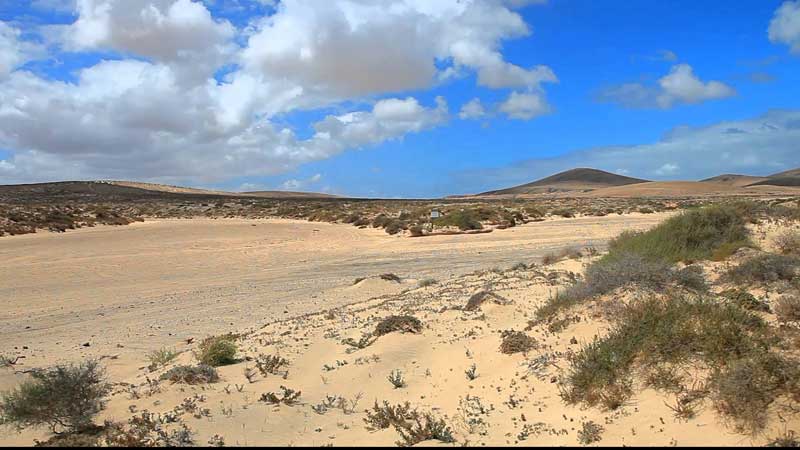
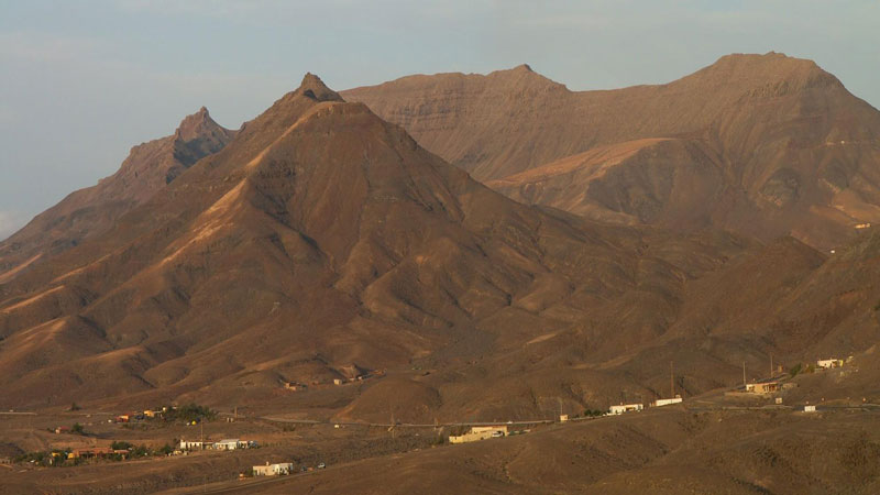
The Canary archipelago consists of seven major islands – Tenerife, Gran Canaria, Fuerteventura, Lanzarote, La Gomera, Hierro and La Palma. Fuerteventura – as are the other 6 major Canary islands – is part of the continental plate of Africa and is a result of a combination of tectonic and volcanic activity. Some 70 million years ago, a magma chamber with the approximate size of Ireland exerted pressure on the relatively young Atlantic sea bottom. Volcanoes arose and created a submarine geography of volcanic origin. Much later – some 20 million years ago – the entire African plate in that area was lifted up by a “Hot Spot” till it emerged from the sea. These geological forces formed the island and from then on Fuerteventura became exposed to erosion by wind and heavy rain. This ancient lifting activity still can be seen in the barranco of Ajuy, where the walls of it are about 180 million years old. More recently – some 2 million years ago – Fuerteventura had frequent periods of volcanic activity and the most recent ones date from about 10.000 – 6.000 years ago. There is a hypothesis that Fuerteventura once had 3 major volcanoes and at least one of them had about the size of mount Teide on Tenerife (about 3.000m). There was one in the North (around Tindaya), one in the Centre (around Betancuria) and one in the South (Pico de la Zarza – Cofete, which with its 807 mtrs altitude, is the highest point on Fuerteventura today). The size of these impressive volcanoes has been significantly reduced due to erosion and major land slides (which still can be seen from space; another devastating landslide is forecasted for the volcano of La Palma, although not foreseen for the coming hundred years). Worthwhile to note is that the East-to-West road from Corralejo to Lajares/El Cotillo runs parallel to the ancient (50.000 years old) coastal line of Fuerteventura. At that time, eruptions from the chain of volcanoes North of Lajares, including the one on Lobos, have covered the old shore and created about 100sqkm of new land. This is why you still can see off-white hills and old dunes around Villaverde, La Oliva, Lajares and El Roque.
Fuerteventura is the second largest of the Canary Islands and is situated approx 100 kms from the Sahara and west coast of Africa. From all the Canary islands, it is the closest one to Africa. Fuerteventura is considered by geologists to be the oldest island in the archipelago. It is about 100 Km long and the main part is 30 Km wide. Fuerteventura is economically the least developed island of the Canary islands because its development started very late due to lack of sufficiant amounts of sweet water. With its population density of 45/sqkm, it is the least populated one (the last census in 2017 resulted in a total of about 100.000 inhabitants for the entire island). When you compare this number with that of the other major islands like Tenerife (800.000), Gran Canaria (600.000) and Lanzarote (142.000), then it is not difficult to imagine how tranquil and deserted it can be here. Just enjoy it!
Human & Political History.
There is no certainty about who the first settlers on the island were and when this has happened. There are a couple of hypotheses, but the most probable one refers to a Berber origin, a tribe of tall, fair skinned, blonde blue eyed people from Northern Africa. Basis for this are Libyan-Berber inscriptions that can be found on mountains where these Berber settlers, also called Majos, originally once lived (please notice the similarity with the actual name of the locals “Majoreros”). They probably have set foot on Fuerteventura some 3.000 years ago, as part of a deportation program of the then dominant rulers of the Mediterranean area, the Phenicians. The fact that the later conqueror Jean de Bethencourt in 1402 found inhabitants, but that they mastered no technolgy to make boats, strengthens this hypothesis of deportation.
The Romans took over power from the Phoenicians by conquering Carthago and deported rebels to the Canary islands in several expeditions. An old Roman “camp” that is estimated to have been erected between 50 B.C. and 50 A.C. and supposedly has been used to extract purple dye from molluscs, was recently discovered on the nearby island of Lobos.
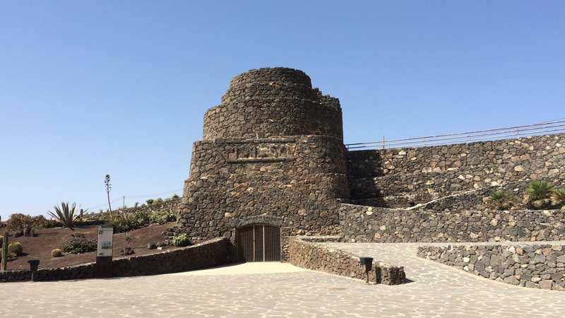
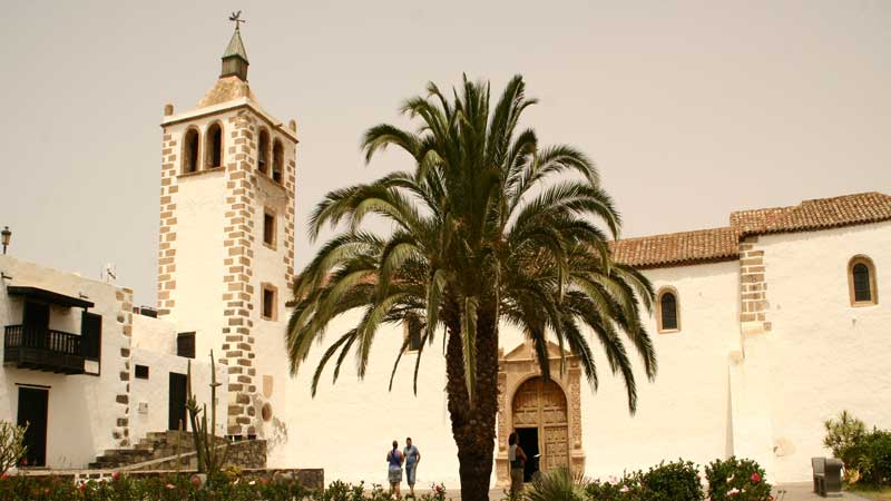
In the beginning of the 15th century the island was conquered by Jean de Bethencourt and Gadifer de la Salle. Jean de Bethencourt organised the expedition to extract the purple red dye from the "Orchilla" lichen. By doing so, he hoped to create a monopoly and to breathe more life into his waning textile company. At that time, there were 2 kingdoms on Fuerteventura. The one in the North was called Maxorata and was ruled by Guize, and the one in the South that was called Jandía, and was ruled by Ayose. Shortly after the invasion by Jean de Bethencourt, both kings were baptised (along with many of the natives). Bethencourt had successfully introduced Christianity to the island and subsequently the kings changed their names into Luis and Alfonso, respectively. The village of Betancuria was created in the centre of Fuerteventura to hide away as much as possible from the marauding pirates. It became a safe haven to settle till in 1593, when Betancuria was erased by Arabic pirates under the leadership of Xabán Arráez who invaded the island with 230 men as revenge for the raids into his territory which were organised from Fuerteventura. Betancuria was rebuilt and soon it became first the capital of the Canary Islands and later of Fuerteventura until 1834. It is here that the Franciscan monks founded in 1423 the Monastery of San Buenaventura of which the ruins still can be visited.
Fuerteventura was first proclaimed a kingdom under the crown of Henry III of Castilla and later became a private property between the 15th and the 18th century. Fuerteventura suffered many invasions from pirates who came from the North of Africa. During these raids many locals were captured and a considerable number of them were forced into slavery.
Economic History.
An economic activity of some significance only started since the arrival of Jean de Bethencourt. Before that time – and even till the 19th century – most economic activity has to be regarded as “survival economics”. The main activity was agriculture and livestock. Fishing was only done to fill in the “gaps” between seasonal agricultural activities. With only very primitive tools available to go out fishing, nobody was fond of “going out far”, as one may understand. Most of the people were not living on the shore, but lived inland because of the availability of sweet water and a better protection from pirates. Only later when the threat from pirates diminished, some villages were built close to the “Barrancos”, the dry riverbeds, and along the East coast because of its calmer sea.
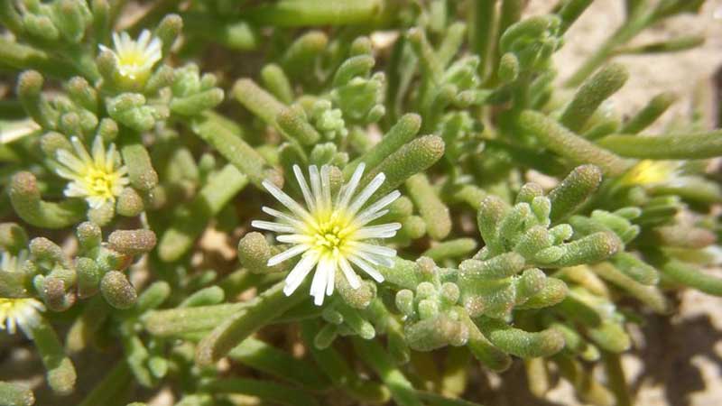
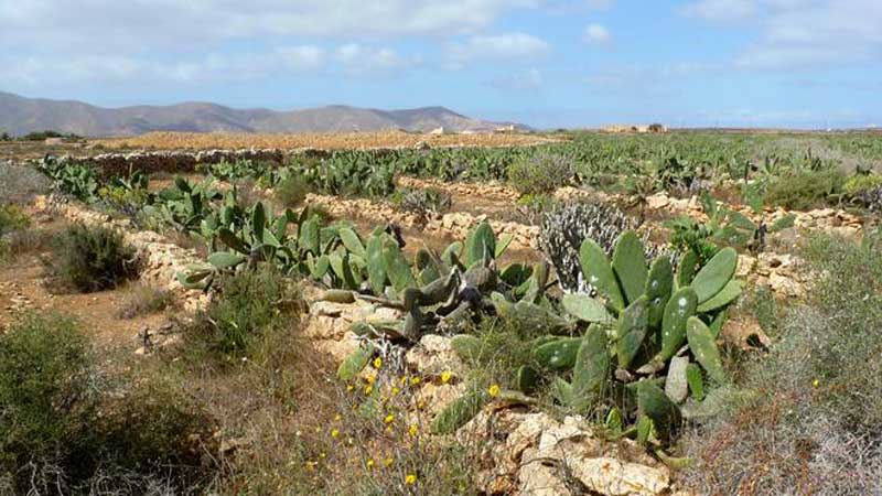
Due to the slightly salty water that was provided from scarce wells, the agriculture was limited to simple and easy-to-grow vegetables like tomatoes, wheat, barley, chickpeas and lentils. The farmers used to build dams around their plots of land (“Gavias”) and they constructed terraces on the slopes of the hills in order to collect the limited amount of water. These constructions still can be seen all over the island and the actual local government is supporting the initiative to re-install the old “Gavias” and construct even more of them.
In the 17th century, people were burning local salty plants from African origin, “Barilla” and “Cosco” to provide the raw material for soda. The vast majority of this product was purchased by England.
At the end of the 18th century many people were involved in the production of burned chalk that was mainly taken out from the areas of Ajuy. They collected the limestone by heavy work and burned it locally. It was then shipped to the other Canary islands or even to mainland Spain. This activity remained till the 1950’s. This “blood, sweat and tears” business regularly represented “the last resort for income” when sufficient harvesting from agriculture and survival of livestock was uncertain due to the unpredictable and harsh climatic conditions. It is reported that chalk burning was one of the major causes for the massive destruction of the once abundant Fuerteventura forest, next to construction and domestic fires for cooking.
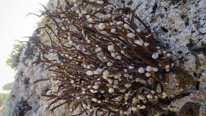
In the middle of the 19th century a new source of income was generated by the cultivation of the larvae of the “Cochinilla”, a tiny insect that lives on certain cacti. The Cochinilla was the supplier of a red colorant (cochineal) for dying purposes. However, due to the invention of the synthetic alternative for the dye in 1880, the business soon died. The remnants of the ancient cactus gardens still can be seen in the area of Pájara. At the same time the rain lacked for almost 5 years and the island really became a desert. This severe drought caused many locals to abandon Fuerteventura and many emigrated to Latin-America.
Tomatoes were cultivated on an industrial level as from 1927, mainly around Antigua and Tiscamanita, but the Second World War and government taxes for export gave the initiative little support. The tomatoes from Fuerteventura are considered today to be among the most flavoursome and they are used in many renowned restaurants in Europe. You really should try them.
Another historic initiative on Fuerteventura was the cultivation of “Agaves”. The Sisal fibres from this plant were planned to be used as material for textiles and bags. However, due to the lower-cost synthetic fibres made by the European chemical industry, this initiative was unsuccessful and soon died, demonstrating another sad example of surrender to the chemical industry.
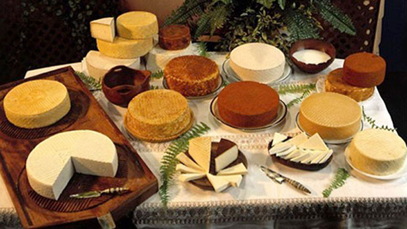
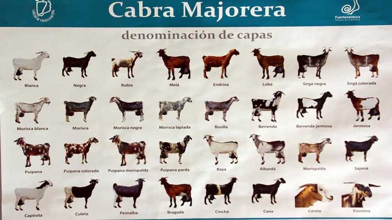
Livestock on Fuerteventura is mainly represented by goats which thrive almost anywhere. They are held in high esteem for their quality milk which is the basis for the famous goat cheese “Queso de Cabra”. The quality is excellent and meets world standards. Proof of this are the many international awards and the officially recognised label “Queso Majorero”. There are 4 major classifications: “Fresco” (fresh), “Tierno” (soft), “Semi-curado” (medium-aged) and “Curado” (aged). There are some taste variations, based on additions like pepper, gofio and smoke. The taste of the “Fresco” is soft and very enjoyable – even for kids – and is certainly not what you expect from a standard goat cheese like at home. Please do yourself a favour and try them all, beginning with the “Fresco” and ending with the “Curado”.
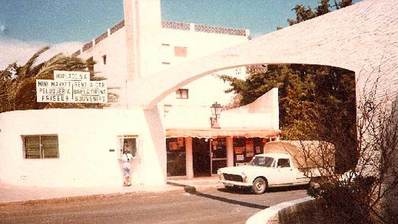
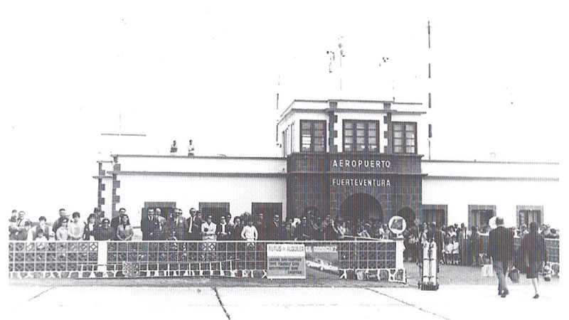
As from the 1960’s, a new source of income was generated: tourism. Fuerteventura was in the very beginning only for the “Happy Few” who could afford the cost and the time to make the bothersome travel by plane. At that time there were no direct flights; minimum 2 or 3 stop-overs. The first visitors discovered the clear benefits of the abandoned island and saw opportunities. Some sources state that the start was given by some Belgian Expats who fled the independency revolution in Congo in the 60’s and who were searching for a similar climate and way of life. According to some sources they built one of the very first hotels on the island: the HOPLACO complex in Corralejo close to the beach. It once stood on the outskirts of old Corralejo and what is left of it is now situated in the centre of the actual town. Corralejo has grown a lot in the last 50 years. HOPLACO may stand for “HOTEL PLAGE CORRALEJO”, a name giving concept that was common in Belgium at that time.
Most of the new tourist complexes nowadays are built outside the villages or even in “the middle of nowhere” so that their impact on the local dynamics and architecture is limited. For this reason you may still spot very nice locations with a lot of traditional buildings in the interior of Fuerteventura. The impression that you may get from Fuerteventura by only staying in the tourist areas is not representative at all for what you may experience by visiting the interior of the island. Get out there, open your mind and prepare yourself for an astonishing discovery tour…